- This topic has 7 replies, 1 voice, and was last updated 6 years, 2 months ago by
DocMartin Williams.
- AuthorPosts
- 9 September 2018 at 1:47 pm #7495
Short film I’ve made on Super Typhoon Mangkhut rampaging across Cheung Chau, southwest Hong Kong:
Update (after passage of the storm), 29 September:
Mangkhut rampaged across Hong Kong, with powerful winds blasting down trees, blowing windows out of buildings [a few highrises losing many windows], but the main impact was storm surge, especially at coastal places in southeast HK, and east facing coasts across south of HK. I was asked how it compared to Hagupit in 2008, which brought a considerable storm surge to sw Hong Kong including Cheung Chau – where I live; my reply:
Been here since 1987!
By far the worst typhoon I’ve known here; even the astonishing number of trees down and with branches broken testifies to that [goes beyond wind speed measurements]
– also things like those concrete blocks thrown by surge waves, from the road to helipad. Chunks of path, fencing, just gone in some places; sizeable rocks from the shore thrown up onto coastal path, right through where there was metal fencing.
As I remember with Hagupit, it was windy but not too bad for wind – gales/storm force would be my memory; just the next day saw the surge had affected south coast of Cheung Chau, a small stretch of concrete path broken. East coast maybe just sand thrown up higher than normal, not very damaging. Saw more damage at beaches along south coast of Lantau. So seemed fairly localised.
Hato a bit similar, though wind more intense.
My impression with surge here on Cheung Chau: during easterlies, it was far worse than anything in past decades; surely to Wanda [1962] or even before.
But by the time the winds were to south, tide going out a little, winds not quite so crazy, so on south coast things weren’t so bad for surge – lucky for south Lantau, I thought; I’d seen a shot of water reaching the road at Ham Tin, Pui O, and suggested a friend living there be ready to move things upstairs. [had seen photos/video by then, as not far away – Sai Kung, Deepwater Bay – the surge from south was much worse than here]
But with Hato, York, other storms – “just” a few trees down, here and there.
With Mangkhut, well not sure anyone will have a real count of trees that have blocked paths, had to be cut away with chainsaws etc; the great piles of branches, tree trunks along paths – took some community effort to shift several piles, clearing paths/roads more, but there’s still a lot left. That’s nothing like past storms I’ve known; more than a quantum leap… Has occurred to me since, looking at table of wind comparisons between typhoons, that somehow the wind speed numbers miss this: the onslaught of winds, causing so much damage. [a lot of energy from Super Typhoon remaining, but the winds rather more spread out, a little slower at the remains of the eye ????]
A beach path just wrecked; with Hato, a small part was broken, this time “protected” with sandbags that were washed away by soon after 3am…
A couple of friends walked by our place during the T10 with Hato; wouldn’t have done so with this.
I knew birding friends wanted to visit Cape D’Aguilar, s HK Island; been before in storms including Hato, but this time decided conditions were too extreme.
I was at Aberdeen Boat Club’s Middle Island clubhouse on Friday last week; saw the effects of surge that must have been around 4 metres there; done story for the Club magazine, on the damage as – I think – surge swept through like a river in flood, maybe without big waves as some things on the bar like wine glasses were still in place, right next to where water carried fridge weighing 250kg and other items, bashing some through walls.
Even in typhoon shelter [Aberdeen], surge also to maybe 4m, but the shelter did work, and sheltered from winds with easterly component, so not much damage.
Update, 2am, 16 September:
Mangkhut rainbands now nearing Hong Kong, visible on radar – light rain first, heavier soon; winds just starting to pick up after a calm evening. Number 8 strong wind signal issued by Hong Kong Observatory.

Observatory info:
Mangkhut continues to move steadily towards the coast of western Guangdong, edging closer to Hong Kong with a high threat. According to the present forecast track, Mangkhut will be closest to the Pearl River Delta around noontime today and local winds will further strengthen. The Observatory will consider the need of issuing higher signals depending on the changes in local wind strength. Members of the public should stay on the alert.
Mangkhut has extensive circulation with fierce winds. Its outer rainbands have begun to affect Hong Kong and local winds have gradually strengthened with gales on high ground. Weather will rapidly deteriorate today with frequent heavy rain and squalls. Sea will be high with swells.
Under the influence of storm surge, a high water level of about 3.5 metres or more above chart datum is expected at the Victoria Harbour between 2 p.m. and 6 p.m today; whereas a high water level of about 4.0 metres or more above chart datum is expected at Tai O between 3 p.m. and 8 p.m. today. The high water level may cause severe flooding in low-lying areas.
The Observatory makes a special appeal to the members of the public to stay away from the shoreline, and not to engage in water sports.
In the past hour, the maximum sustained winds recorded at Tate’s Cairn, Waglan Island and Cheung Chau were 77, 66 and 50 kilometres per hour with maximum gusts 99, 83 and 69 kilometres per hour respectively.
Update, 5pm, 15 September:
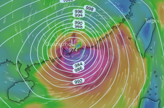
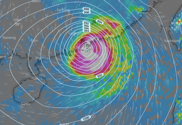
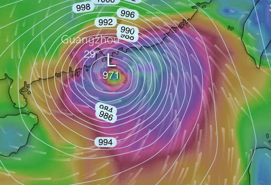
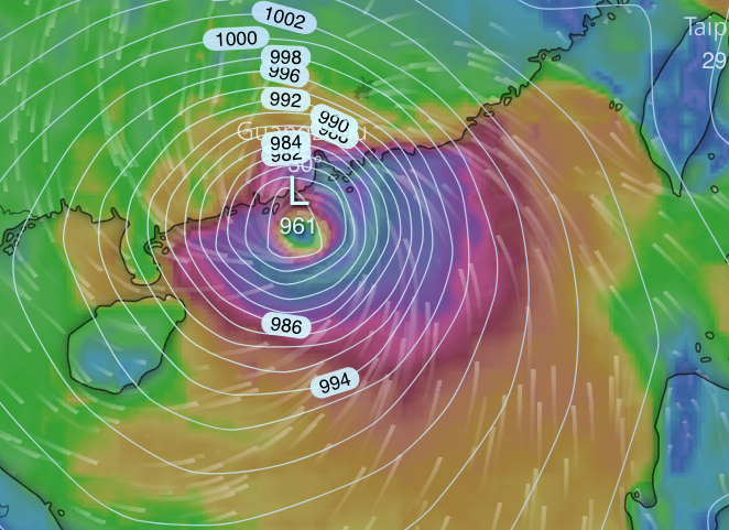
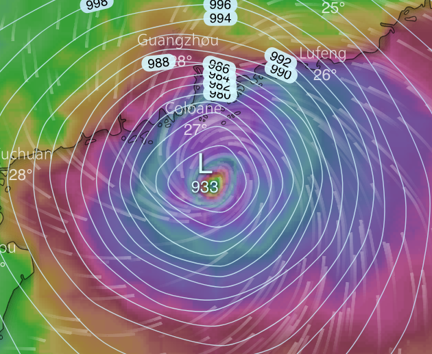
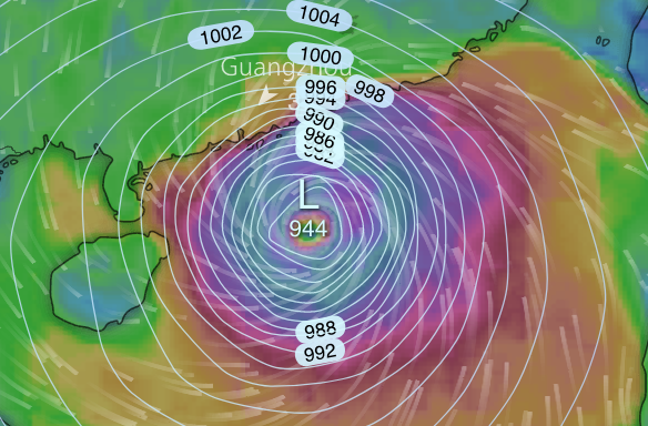
GFS and ECMWF models, from updates within last hour or so; here for 1pm tomorrow – a “direct hit” on Hong Kong, with eye passing only just to south. [slightly lower pressure with ECMWF]Can expect eyewall winds; maybe down to Category 2 on hurricane scale, inc according to JTWC; but HK Obs still 195kmhr closest to Hong Kong – still “super typhoon”
 Rain just appearing on HK Obs radarHK Obs now with an estimate of 2m storm surge in the harbour; lucky it’s not coinciding with main high tide of the day, but still could have quite an impact, and surge can vary from place to place. HK Obs bulletin:“Mangkhut continues to move rapidly towards the coast of western Guangdong, posing a severe threat to the region.Mangkhut has extensive circulation with fierce winds. As Mangkhut edges progressively closer to the vicinity of the Pearl River Estuary, the weather over the region will deteriorate rapidly around midnight. The Observatory will issue the No.8 Gale or Storm Signal around midnight.There are significant swells today. The Observatory makes a special appeal to the members of the public to stay away from the shoreline, and not to engage in water sports.Adverse weather will prevail tomorrow with winds strengthening rapidly and frequent heavy rain and squalls. Sea will be high. Under the influence of storm surge, a high water level of around 3.5 metres above chart datum is expected at Quarry Bay between 1 p.m. and 5 p.m tomorrow, or about 2 metres above the normal tide heights. The high water level may cause severe flooding in low-lying areas.”T3 now; T8 likely after midnight; T10 hurricane force winds signal for tomorrow
Update, 6.30am, 15 September:
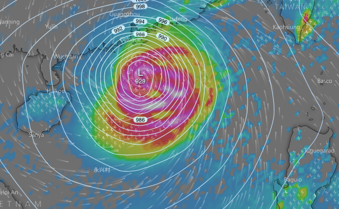
Super Typhoon Mangkhut – headed for near Hong Kong [maybe landfall not far west of Macau]; strong to hurricane force winds expected tomorrow, also chance of severe storm surge [computer model forecasts, from ECMWF, for 10am]
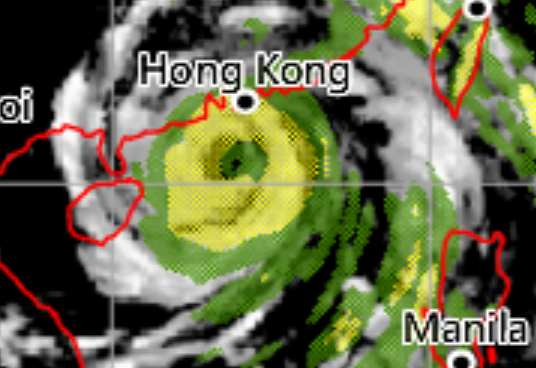
May well be most severe storm on record for Hong Kong. Satellite image; just crossing north tip of Luzon.

ECMWF forecast, for tomorrow, 10am:

HK Observatory http
 /my.weather.gov.hk/:
“Mangkhut is moving across the northern part of Luzon briefly. Under the influence of the terrain of Luzon, there may be some slight changes in the intensity and movement of Mangkhut.
Mangkhut will enter the northern part of the South China Sea this morning and move rapidly towards the coast of Guangdong. Mangkhut will maintain super typhoon intensity with extensive circulation and high winds. It will pose a severe threat to the region. The Observatory will issue the Strong Wind Signal, No. 3 later today.”
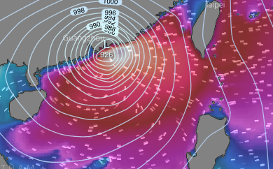
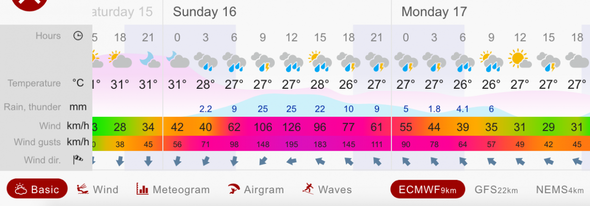
via windy.com, ECMWF forecasts for weather and waves at Shek O, east HK Island
Hurricane force winds; waves to 6-8m and higher.


Update, 7pm on 14 September:
First, quoting HK Observatory:
As Super Typhoon Mangkhut has an extensive circulation and took a more northwestward track with higher speeds, the threat to the vicinity of the Pearl River Delta is increasing. The Observatory will consider issuing the Standby Signal, No. 1 tonight. Members of the public should complete all precautionary measures as soon as possible.
Issued at 18:45 HKT 14/Sep/2018
Notes I’ve just posted on Facebook:
Today, Super Typhoon Mangkhut – “Extremely Catastrophic Super Typhoon Mangkhut” as Philippines weather service called it – has taken rather more northerly track than expected.
Means it may only graze north tip of Luzon; great danger there, but also means a course somewhat nearer Hong Kong than had been forecast earlier today. And more powerful storm; maybe Cat 4 on hurricane scale. So may indeed be the most intense storm on record for Hong Kong.
– potentially devastating for Pearl River Delta region, especially for storm surge, which could be major even though it’s low tide in daytime as it is forecast to pass by.
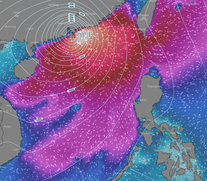
Here, a wave height forecast for 2pm Sunday: notice over 10m waves forecast for near HK, blasted inshore by hurricane, storm and – eventually – gale force winds.

Update, 8am on 14 September:
Super Typhoon Mangkhut is still a monster storm – Hurricane Florence is a bit puny by comparison. Just seen sustained winds to around 250km/hr; found that T Jebi winds around 167km/hr as it battered Kansai Airport area. Lots of rain; even for coast without normal storm surge risk, could be issue, and Luzon looks set for a pounding.
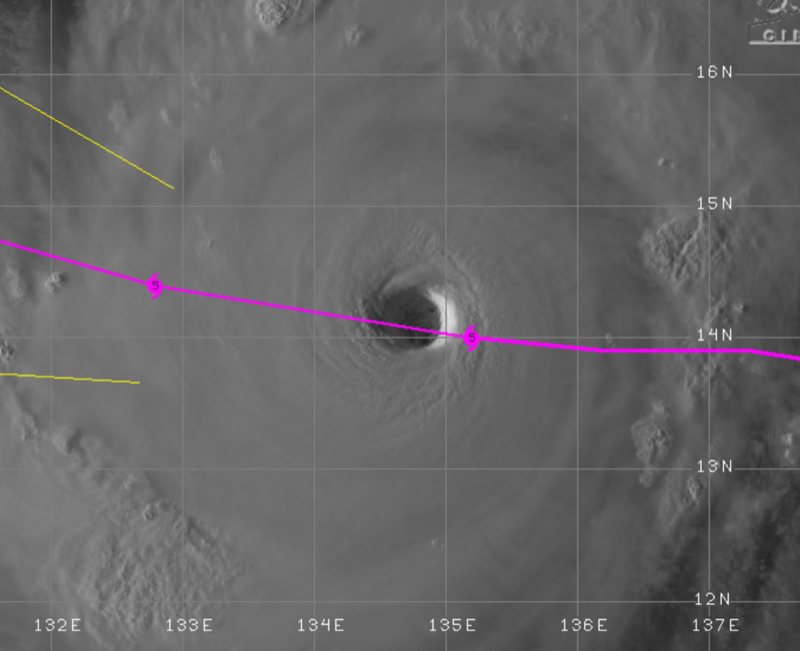
Noticed the eye is just north of the forecast track in image here; see if anything “in” this, as only slight north shift would mean closer to Hong Kong.

European and GFS models similar positions for Sunday, here at noon; GFS significantly higher pressure = less intense. HK Obs still with v strong winds, maybe to around 200km/hr as it passes HK

HK Observatory model here too; shows projected rainfall, 2pm Sunday]; Obs gets extra data for S China area that’s not in global models.

So for HK, still seem set to miss the craziest, eyewall winds and rain, and storm surge.
 But still winds gale force, and perhaps/probably higher [surely higher in exposed southern places]. Storm surge too; seen a model with 1m projected [via GDACS], but I think on low side after T Hagupit led to strong surge tho 200km away. Offset by tide being low most of Sunday daytime, as Mangkhut set to pass us.
Usually storms lose a lot of power crossing Luzon – ie while wreaking havoc there; have to see if this does too, and if any course change as result.
Update, 4pm on 13 September:
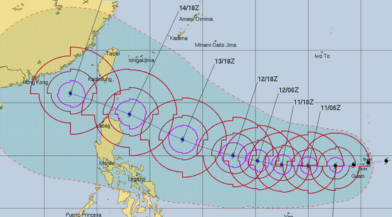
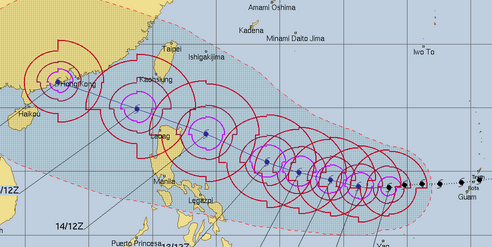
Forecast tracks for Mangkhut have changed considerably: early, before typhoon formed, seemed maybe headed to east China; then towards Taiwan. For a while, seemed set to pass through Luzon Strait towards Hong Kong. But now, more southerly, to pass over north Luzon, and then towards Hong Kong but curving northwest to maybe pass north of Hainan and to north Vietnam. As in this forecast track from HK Observatory.

Though it may pass over 100km south of Hong Kong, will be windy here [gales, maybe some hurricane force]; but also chance of storm surge – rather as Typhoon Hagupit passed 200km to south yet caused storm surge. Against which, tide will be low as the typhoon is forecast to be closest.
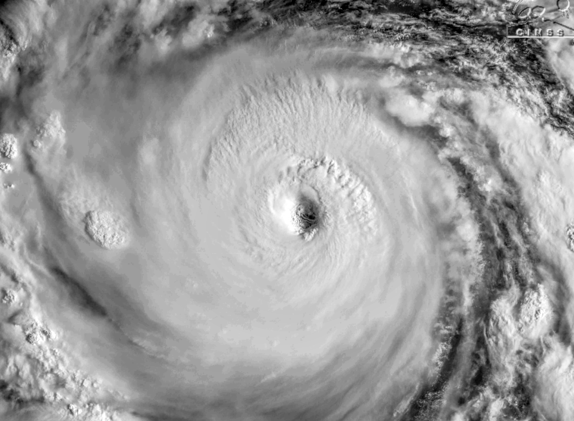
Meanwhile – the storm itself; now the strongest storm on earth this year, see if it intensifies more to enter record books as one of strongest on record anywhere [already close to being more intense than any Atlantic hurricanes]. A “perfect” storm in satellite image from this morning:

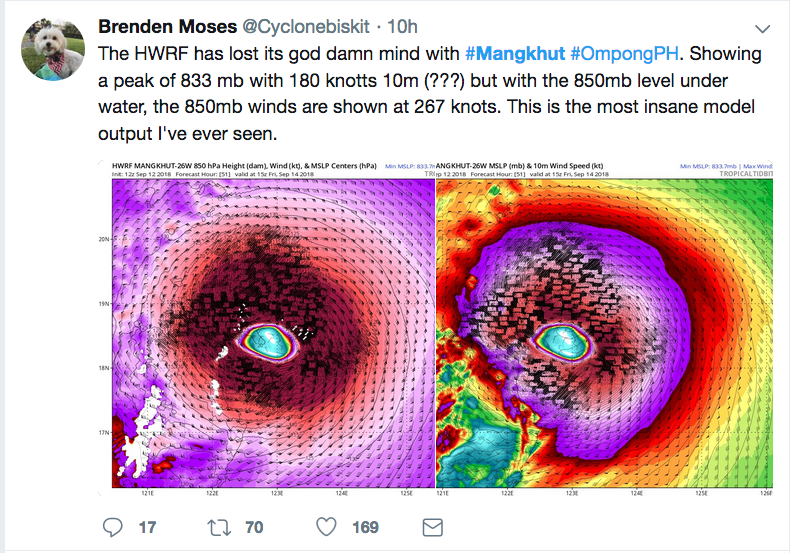
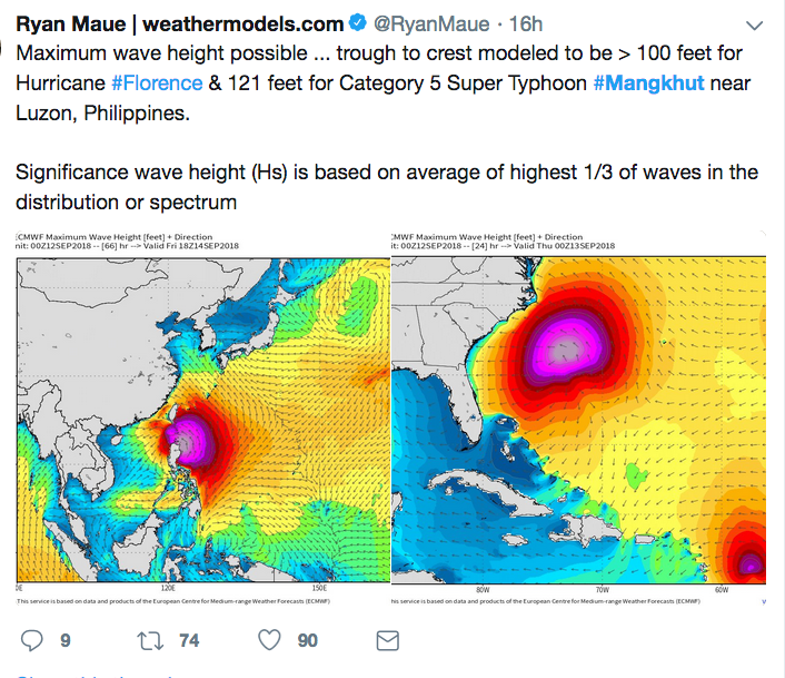
Over on twitter, somewhat muted re #Mangkhut, especially with Hurricane Florence headed for the southeast US. But some are taking note, for instance:


World Meteorological Organization; maybe not given to hyperbole:

Update, 6pm on 12 September:
Now looks as if the storm may lose quite some power from current super typhoon status, perhaps pass over north tip of Luzon rather than miss it, and landfall southwest of Hong Kong.
This from ECMWF; a change from some consistency with Hong Kong as landfall, or very very close.
Still set for strong winds, likelihood of storm surge [maybe not very damaging].

Here’s a satellite image; almost last light of the day, with the huge eye [26 nautical miles, around 45km, says JTWC].

Update, 6pm on 11 September:
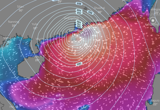
Another forecast for Typhoon Mangkhut from European, ECMWF, computer model; consistency in forecasts from models including this one, with landfall over or near Hong Kong looking very possible.

Storm still a few days away; this is for 2pm Sunday, and landfall to east of HK would lead to it powering down.
But position like this, real dangerous including for storm surge. Waves set to be extreme; 6m or more in height near centre of storm.

Now a very obvious eye in Mangkhut, via: http://tropic.ssec.wisc.edu/#

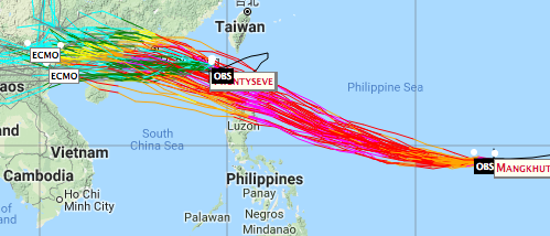
Also added “spaghetti tracks” from European model; it’s a computer programme, given data, and comes up with “runs” as forecasts, then the “best” one is chosen for image as the one here.
But as this shows, other possibilities arise from the same input data; not quite butterflies beating wings to cause hurricanes, but shifts in pressure systems here and there can cause significant differences.
From: https://ruc.noaa.gov/tracks/

Joint Typhoon Warning Center info now includes:
“BY TAU 120, THE SYSTEM WILL STILL BE A STRONG 100-KNOT TYPHOON BEFORE IT MAKES LANDFALL IN THE VICINITY OF HONG KONG. ”
https://pzal.ndbc.noaa.gov/collab/jtwc/
……………………..
Here’s original post from 9 Sept:
Though it’s early days yet to be confident regarding landfall, it’s “interesting” to see the forecasts for Typhoon Mangkhut (Mangosteen) – which looks set to soon become a super typhoon, and may then head towards the Luzon Strait, perhaps passing through and coming close to Hong Kong.
Here are “spaghetti” tracks from the European, ECMWF model. In fair agreement with other models just now.

And here, also from ECMWF, forecast for night of 16 September 2018.
 9 September 2018 at 11:29 pm #8960
Agreement this morning between “best” forecasts from ECMWF and GFS re landfall for Manghut, pretty much right on Hong Kong.
ECMWF (via windytv):

GFS:

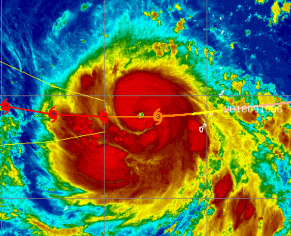
Enhanced satellite image; with track showing expected intensification, swiftly from Simpson Category 1 to 4 – approaching super typhoon.
 10 September 2018 at 10:00 am #8961
Latest from ECMWF; here showing wave heights – 6-8m and higher around eye; for Sunday 16 Sept afternoon.

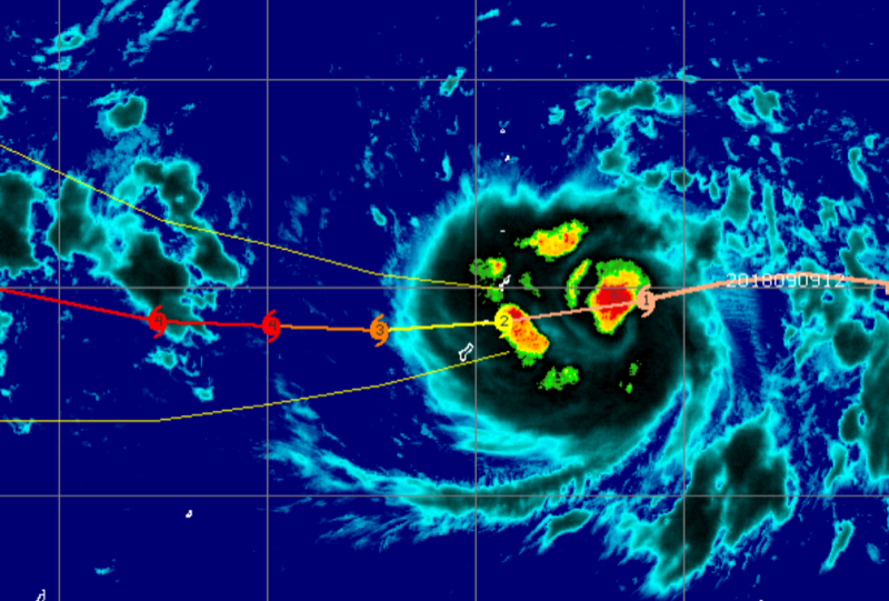
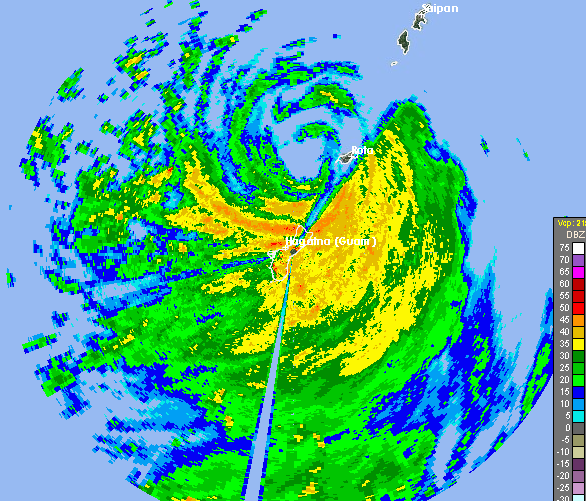
Here, from weather radar at airforce base on Guam, which the storm is now passing:
 10 September 2018 at 11:29 pm #8962
Joint Typhoon Warning Center, basing forecasts on various computer models; notes strong agreements in track; likely to be super typhoon, but in S China Sea indications it may lose strength a lot [seems pretty likely for a typhoon into S China Sea]; or may sustain much of it

European – ECMWF – model for 6pm Sunday 16 September
GFS via windytv, also, is very similar, but pressure not so low [so less intense]
Remember a small shift to north or south can make big difference, esp if lands to east of HK and powers down over land
 rain forecast from ecmwf
Waves forecast; water sloshing about in S China Sea, with monstrous waves around eye

enhanced satellite image of mangkhut; eye clearly visible
 11 September 2018 at 4:44 am #8963
From HK Observatory, around noon today:
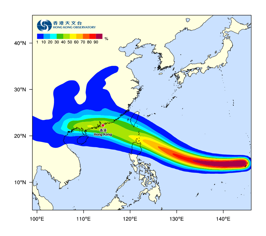
‘The “Tropical Cyclone Track Probability Forecast” webpage provides the probability that a tropical cyclone (TC) will pass over a given location in the coming 9 days. …
The TPFM is automatically generated by computer using data from Ensemble Prediction Systems (EPS) of weather models without manual adjustment. The probability at each map location represents the chance of a tropical cyclone crossing within 120 kilometres of that location in the coming 9 days. Such chances are represented by colours on the TPFM: reddish for higher chance, yellow for medium chance (around 50%) and bluish for lower chance.’
 11 September 2018 at 11:26 am #8964HK Observatory videoLandfall to east of Hong Kong – not such a big deal; storm powers down over land, north winds are strongest here so little chance of storm surgeLandfall just to west: storm remains over sea, still strong; get intense southerly winds and can be storm surge [which is the greatest threat with typhoons/hurricanes]11 September 2018 at 2:13 pm #8965another update from joint typhoon warning center; maybe typhoon not quite so strong at landfall, tho HK Obs still has it remarkably powerful“INTERACTION WITH LAND AND DIMINISHING OUTFLOW WILL PRIMARILY BE RESPONSIBLE FOR ITS GRADUAL DECAY. HOWEVER, BY TAU 120, THE SYSTEM WILL STILL BE A SOLID 80-KNOT TYPHOON WHEN IT MAKES LANDFALL TO THE WEST OF HONG KONG. “
 11 September 2018 at 11:42 pm #8966
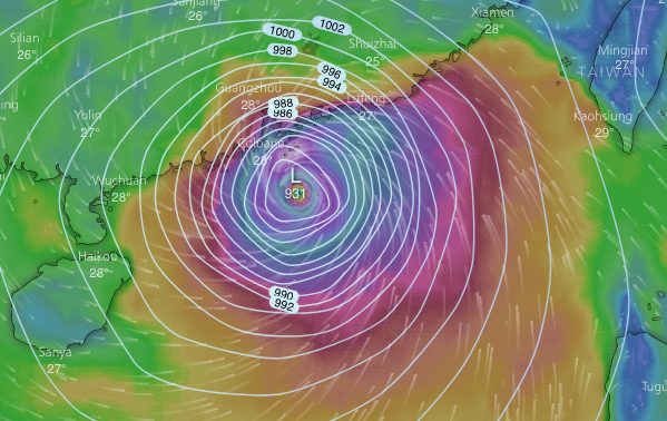
Forecasts still consistent; the best model from ECMWF v similar; here for 10am Sunday. Pressure of 931mbar is lower than for HK’s strongest storm on record, Typhoon Wanda of 1962
“Wildcard” will surely be interaction with Luzon; will it pass just to north, or slam into the island with its mountains????

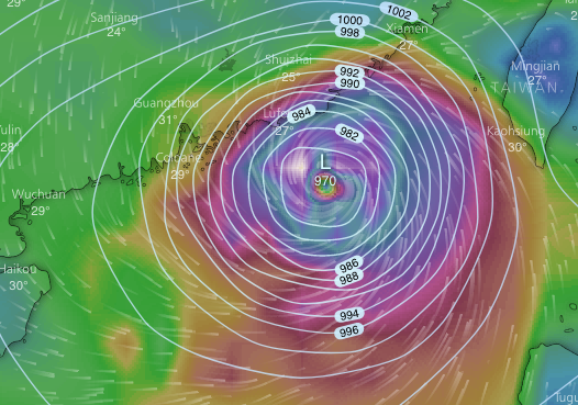
GFS model; much the same track, but pressure 970mbar, significantly higher than from ECMWF so less intense storm [still not to be trifled with]

Joint Typhoon Warning Center mentions 24 nautical mile [44km] wide eye; mentions landfall south of Hong Kong [well, see about that – will it wind up nearer Hainan, say?]
Eye easily seen here; a startling looking storm; ranking category 5 on hurricane scale, super typhoon

And here, some tracks from a few models [spaghetti]; southern one is COTC, a US navy model that’s generally not too accurate
Looking for info on this model, I found this handy article – notes that not all models are created equal by any means

Article just linked to advises looking at ensembles – products of slightly different “runs” – for good models like ECMWF. So here’s one; and it’s not bang up to date, just helps show what forecasts we see are based on [which here should include ideas of how storm will interact with Luzon]

- AuthorPosts
- You must be logged in to reply to this topic.


 /my.weather.gov.hk/


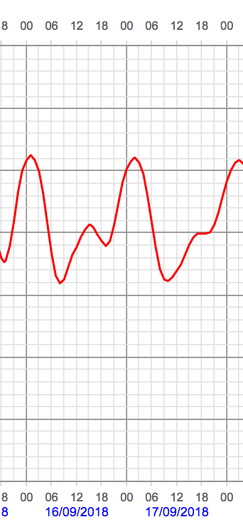 But still winds gale force, and perhaps/probably higher [surely higher in exposed southern places]. Storm surge too; seen a model with 1m projected [via
