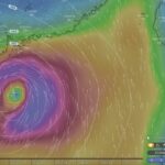
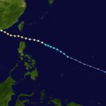
As well as employing computer models and weather station info, the Hong Kong Observatory is employing reconnaissance flights to gather data from within tropical cyclones.
Late in the afternoon of 13 August, while the Number 3 signal was issued in Hong Kong, meteorologist Wong Wai-kin was in a small plane over the South China Sea, flying at 8000 feet, just above the main clouds swirling around Severe Typhoon Utor. The centre of the storm was nearby, and the plane began descending through dense clouds.
Rain pummelled the windows. The visibility became almost zero, as if in thick fog. In the violently swirling air, the plane bounced like a sampan bumping over two-metre waves.
After 10 to 15 minutes, the plane emerged from the cloud, and entered clear air with calm sea below, blue sky above: the eye of Utor. For Wong, it was a precious moment; he became the first of the Hong Kong Observatory’s current staff to fly into the eye of a severe typhoon. But this was also a significant milestone in research about typhoons, the west Pacific’s mighty, sometimes devastating storms.
Though in recent years many people may have viewed close approaches by typhoons as little more than a chance for time off work and maybe a party, they have proven deadly in Hong Kong. Observatory director Shun Chi-ming cites three of the most lethal: “Over 10,000 people died during storms in 1906 and 1937, and in 1874 over 2000 died, when Hong Kong was only Hong Kong Island and Kowloon.”
Some weather-wise local people had an inkling of a typhoon’s approach in 1874, but there was no official warning as it was nine years before the establishment of the observatory. In 1906, a warning was issued just 20 minutes before gales began blowing. By 1937 forecasts had improved, yet though over a day’s notice was given of an approaching typhoon, it arrived overnight and the onslaught took many by surprise.
Satellite images a boon to forecasters
From 1966, the Hong Kong Observatory has employed satellite images to help with routine forecasts. Satellite data is now pivotal to analysing tropical cyclones like typhoons. As well as light in the visible spectrum – which is only useful in the daytime – they employ microwaves and infrared radiation, to provide estimates of upper-air cloud movements and temperatures, as well as wind speed and direction near the sea surface based on signals scattered by waves.
This wealth of information, along with observations from weather stations, ships and ocean buoys, plus radar data, is input to computer models that can predict how storms will develop and where they will head. There are several of these models, some spanning the globe, others with a regional focus.
The Hong Kong Observatory has a computer model that covers east Asia and the west Pacific. It runs on a fast computer system housed in a row of black towers the size of tall filing cabinets, with racks of processing units that can together perform 7.7 trillion operations per second. “The computer weather model is based on an operational model system from the Japan Meteorological Agency, and every three hours we run a three-day weather forecast,” says Wong. The computer system can also process products for specialized users and applications, and create images for television broadcasts.
Although models are undergoing continual development, they still struggle to accurately predict typhoon intensities and tracks. Problems include forecasting the existence and strength of a high pressure system that tends to guide typhoons westwards, while if it weakens they turn north and then northeast. “This recurvature is very difficult to predict, and storms will either move west-northwest or northeast – the forecast can’t be in the middle,” says Shun.

When a typhoon looks set to impact Hong Kong, at least four forecasters man the observatory’s forecasting room round-the-clock, where banks of monitors show radar and satellite images, wind measurements and more. The director assisted by an assistant director is stationed at a table with an in-built computer screen showing a range of computer forecasts, using these plus real-time observations and experience to decide which warning signals to issue, and when.
Flying into the storms
With typhoons posing threats to life and property, the observatory team is always seeking ways to improve forecasts. One way is by using reconnaissance flights to gather data from within storms. The US heavily relies on flights to assess hurricanes, but in this region there have recently been few flights other than occasional research missions flown by Taiwan, which do not reach the South China Sea near Hong Kong.
Other than a trial flight in 1973 by the late director Mr Gordon Bell, the Observatory had not overseen or participated in such flights until two years ago. In 2009, an Observatory team equipped a Government Flying Services plane with a weather probe, looking like a small torpedo mounted below a wingtip. This was used to gather data on flight paths around the airport to collect data for supporting the development of the wind shear and turbulence alert service. “I talked with Michael Chan, the GFS controller, and asked if they could fly into typhoons,” recalls Shun. “He said yes.”
Beginning with Tropical Storm Haima in June 2011, pilots flew missions into storms south of Hong Kong. Wong and colleagues then took data from the probe, and added it to the computer model, finding that it helped to improve forecasts.
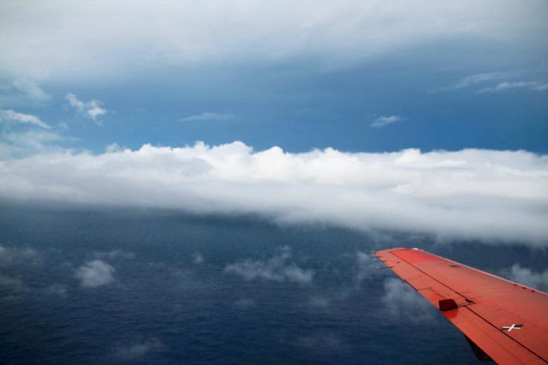
Photo in eye of Severe Typhoon Utor, by Wong Wai-kin
During the recent mission into Utor, Wong made three small circuits within the eye, searching for the lowest air pressure he could find. “I remember former director C.Y. Lam asking if the minimum air pressure zone of a tropical cyclone is a point or an area,” he says; Then, pilot Keith Ma headed north and into the eyewall, returning homewards at an altitude of just 3000 feet – keeping as low as reasonably possible to record powerful winds.
After processing the data, Wong noted that winds were at least gale force until he reached 290km from the centre of Utor. This agreed fairly well with satellite data, helping Shun with a decision to issue the Number 8 signal as Utor neared Hong Kong.
Successes like these spur the continuation and improvement of Hong Kong’s typhoon reconnaissance flights. Late this year, Government Flying Services will begin operating a new plane with better weather monitoring equipment relaying directly via satellites. With Wong or a colleague on board, this will also release dropsondes, cylinders packed with sensors that descend on parachutes, transmitting information on wind speed and direction, air pressure, humidity and temperature until they hit the sea and are lost, swallowed by the storm.
Published in Sunday Morning Post.
Further reading includes:
Tracking and Forecasting Tropical Cyclones on Hong Kong Observatory website
Weather including tropical cyclones
Rare November Tropical Cyclones Including Typhoons in Hong Kong
As I write on 13 November 2024, Tropical Cyclone Toraji is set to pass over Hong…
Typhoons and Rainstorms Past Help Hong Kong Forecasts Today
Wetter, Wilder Weather Events Loom with Warming World You may find yourself on a Hong Kong…
“Typhoon to Hong Kong Soon” Makes Great Clickbait
While Hong Kong is sometimes hit by typhoons, predicting them in advance is tricky. Yet this…
Lightning-packed Supercell over Cheung Chau, Hong Kong
Yesterday evening (30 April 2024), weather monitoring imagery showed an intense rainstorm/thunderstorm area – a “supercell”…
Tropical Cyclone Ma-on Headed for Hong Kong
25 August 2022 (evening) update: Ma-on took a track somewhat south and west of earlier forecasts;…
Severe Typhoon Mangkhut highlights perils of massive reclamation by Lantau
Typhoon Mangkhut helped show “storm surge” is a threat to modern cities, not just something for…
Typhoon Jebi a Warning for East Lantau Metropolis aka Lantau Tomorrow Vision
To anyone concerned about plans for Lantau Tomorrow Vision, the clobbering of Kansai by T Jebi…
Mad Lantau Metropolis Plans Should be Scuppered by Storm Surge Threat
A consideration of science suggests the reclamation plans, including for East Lantau Metropolis are foolhardy, even…
As Hong Kong Sizzles the World Keeps Warming
While climate change may have long seemed an issue for hardcore, tree-hugging environmentalists, concerns are spreading.
Typhoon Haiyan Lessons for Hong Kong
Typhoon Haiyan was among the strongest storms on record, and devastated a swathe of the Philippines.…
Hong Kong weather outlook warmer wetter wilder
With global warming only just getting started, according to scientists, it’s time for Hong Kong to…
Typhoon Vicente hurricane force winds blast Hong Kong
Severe Typhoon Vicente slammed Hong Kong on 23 and 24 July 2012, with hurricane force winds…
Severe Tropical Storm Pabuk
Severe Tropical Storm Pabuk looked set to have passed Hong Kong, barely causing an impact other…
HK Number 8 Signal
Hong Kong's Number 8 tropical cyclone warning can be controversial.
Hong Kong Typhoons including Calamitous Storm Surges
Typhoons have sometimes caused massive damage and loss of life in Hong Kong. Just months after…
Hong Kong tropical cyclones
Hong Kong can be impacted by tropical cyclones including and typhoons. Happily, typhoons are scarce near…


