
 The northeast New Territories encompasses some of Hong Kong's wildest landscapes.
The northeast New Territories encompasses some of Hong Kong’s wildest landscapes.

The northeast New Territories encompasses some of Hong Kong’s wildest landscapes, with hills cut by a myriad valleys, and inlets and headlands facing towards Double Haven (印洲塘), Mirs Bay.
I hiked there with Charlie Frew – restraining himself to well below adventure racing pace. As it was a hot day, initially aimed to keep to the lowlands, making for Lai Chi Wo (荔枝窩) on the east coast, then walking back westwards. But, after a wild rush of blood to the head, also added ascent of the area’s highest peak, Tiu Tang Lung.

We atarted at Wu Kau Tang (烏蛟騰), following an easy trail southeast through Kau Tam Tso, then swinging east towards Sam A Chung. Here the trail was pleasant, often in shade, running by a stream that leads towards Wu Kau Tang, and later another stream bound for Sam A Chung.
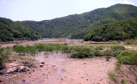
“Chung” can mean the tidal stretch of a creek; and sure enough at Sam A Chung there’s a tidal creek, with some mangroves (left). North from here is the inlet by Sam A Tsuen.
There were two hamlets at Sam A Tsuen. One built just above a marsh (left); and another a little inland, just before the path climbed a little, to cross a small pass – Shan Mei Au – before dropping to the coast again.
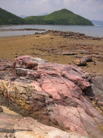
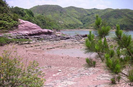
There are rocky outcrops on the coast; but unlike the sedimentary rocks of Sam A Tsuen, these are mainly volcanic.
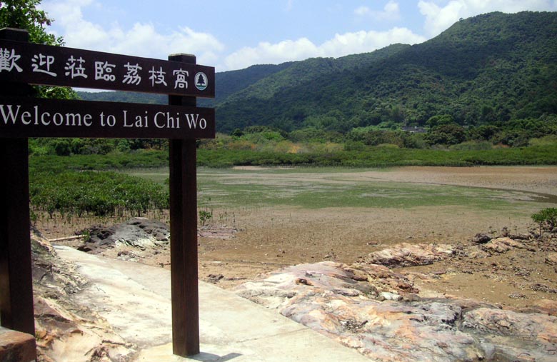
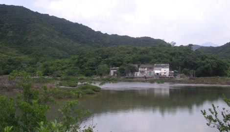
This is the location of the main village in this far-flung corner of Hong Kong, Lai Chi Wo. Here, too, is the best sea-grass bed remaining in Hong Kong: at low tide, the flattened “grass” looks like a mat of algae. These aren’t really grass, but flowering plants that are adapted to living in submerged places.

On towards the village, the path passes a belt of mangroves, which grow higher up the silty beach.
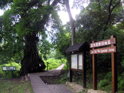
The Agriculture, Fisheries and Conservation Department has established a nature trail at Lai Chi Wo, with walkways, and information boards including this one (on – yes – mangroves).
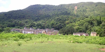
Just inland, across an area that can be marshy, Lai Chi Wo lies at the foot of hills – and just below one of the best fung shui woods in Hong Kong.

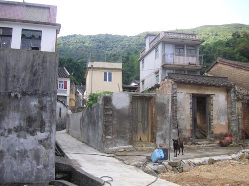
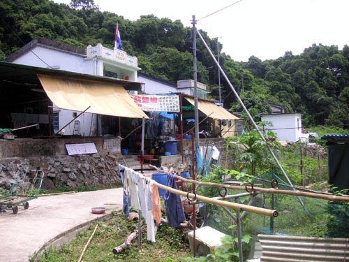
Lying far from roads, so reached only by hiking or by boat (there’s a small pier), Lai Chi Wo retains its traditional character. Tourism now brings some revenue, though mainly at weekends on public holidays, as the main “ecotourists” are Hongkongers. Following plans drafted during a long and perhaps expensive process overseen by the Tourism Commission, the Hong Kong Tourism Board is launching northeast New Territories boat tours which could boost local incomes – if successful.
There’s a small information centre for the Hong Kong National Geopark just inside the village’s main entrance.
As the name suggests, this area was once known for its lychee trees. But in the 1960s and 1970s villagers found it more profitable to plant Mandarins, which could fetch good prices towards Chinese New Year (as they are seen as auspicious), and lychee trees became scarcer.
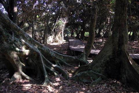
Much of the fung shui wood is now a Special Area, affording greater protection than would extension of the country park. Over 100 plant species have been recorded here; and the wood is notable for some big old trees – four are included in the government’s Register of Rare and Valuable Trees.
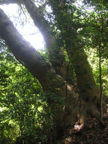
In this photo, there’s a large – over 20 metres high, 2.5-metre diameter – autumn maple, which has become a climbing frame for an impressive banyan tree, growing as a strangler fig. Someday, perhaps, the banyan will win out, and the maple will rot away in the middle.
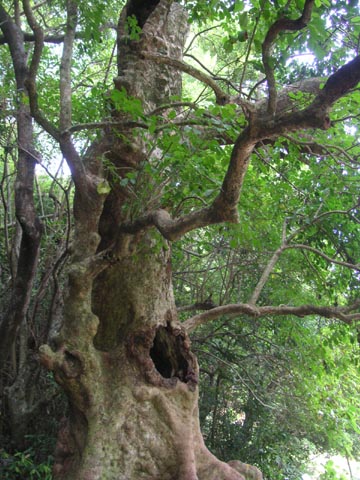
Two other notable trees are the Hollow Tree, at left here. This too is an autumn maple, the middle of which has rotted away, leaving a space big enough for a person to fit in; the outer trunk is still alive.
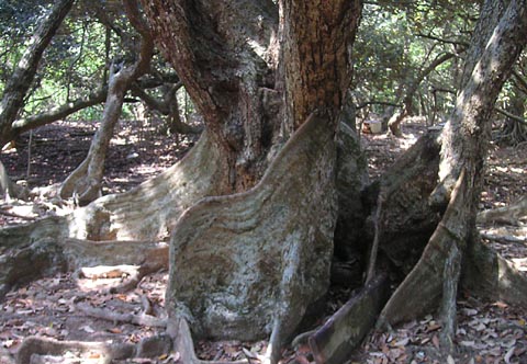
On the right here – and at the top of the boardwalk up along the edge of the fung shui wood – is the Five-finger Camphor, a camphor tree known for having five major stems (after coppicing v early in its life??). During the Japanese occupation, soldiers threatened to chop it down – to better see any guerillas hiding nearby and/or for making furniture, but villagers protested, and the Japanese chopped down just one stem (leaving four “fingers”, though I managed to take photo from an angle at which one is hidden). The diameter of the combined trunks at the base is around three metres.
The two maples and the camphor tree are in the trees register; along with a grand Chinese banyan just below the village.

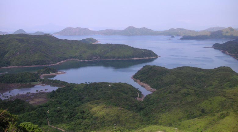
Facing towards Double Haven, Lai Chi Wo is in a beautiful setting.
– hard to believe looking at this that eastern Shenzhen, including a burgeoning container port – is little more than a stone’s throw away!
Between the village and a small creek are more impressive trees. These are looking glass mangroves Heritiera littoralis – a species that, at least in Australia (I learn via googling) tends to grow at the landward edge of mangrove belts, especially in areas with a substantial freshwater influence.
While Hong Kong mangroves are otherwise small, often no more than shrubby trees, these are grand trees, with pronounced buttress roots. A boardwalk loops through the small wood, which seems wonderfully primeval – the more so as the trees are hung with a creeper with stems up to a foot (a third of a metre) thick.
Leaving Lai Chi Wo, headed back to Sam A Chung, then – after checking the map – took a path heading a little inland of our previous route, towards eastern spur of Tiu Tang Lung (吊燈龍; Lantern Hill). Then, decided to go for it, and climb up and over Tiu Tang Lung – on this fine afternoon, the views should be good.
Indeed great views – here’s shot from part-way up the spur, with Sam A Tsuen below, Double Haven beyond. Much of the area visible beyond the shore here is in Yan Chau Tong Marine Park.
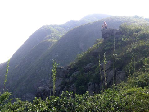
Charlie fairly scurried on up the hill. Weighed down by camera gear (err, well, a bag with camera and couple of lenses), I went more slowly. My main concern was that it was hot, and I had little water left, so taking care not to dehydrate.
A fairly tough climb, but well worthwhile; had the peak – as most of the area all day – to ourselves. (Met hardly anyone outside the villages.)
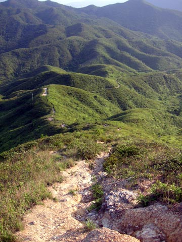
Here’s the trail we took down Tiu Tang Lung, leading south from the summit. Yes, v rough, and steep; care needed.
lai chi wo
Too bad the views rarely look like these photos any more as we have so few clear days. Such a shame. It’s a wonderful walk and Lai Chi Wo is very well kept and attractive but a word of advice to anyone doing the walk, stop at the restaurants in Sam a Tsuen for a meal, there’s nothing in Lai Chi Wo.
Lai Chi Wo n food
Yes, the pollutions’ a major bummer; if to take photos, I have to try n choose days for walks pretty carefully, or get very lucky. Shots above from a hot summer day, when did set out as weather looking clear, breeze from the sea. Even so, by time we got to top of Lantern Hill, some smog was drifting back in, so views n photos from the top not as great as I’d hoped.
Good point re eating at Sam A Tsuen; when last at Lai Chi Wo, did see locals putting out tables w some food (on a Sunday, evidently anticipating many hikers), but not to be relied upon, esp weekdays. And on weekdays, I’d caution against relying on finding food/drink anywhere on route, as suspect Sam A Tsuen stores might shut at times, albeit maybe rare for all places to be shut at once.
Hazy photos
With regards to hazy photos, have you tried a circular polarizer filter? These usually work a treat as light reflecting off pollution becomes unpolarized, or in simple words, it bounces in all directions giving it an unclear look. If you have multiple lenses then get one for your largest lens then buy stop-down rings for your other lenses, saves you money that way. Also, don’t use a polarizer below 26mm as you get very uneven polarization on blue skies. Polarizers should be in the kit bag of all photographers, especially when shooting in the daytime, although you also lose 2 f/stops of light, so you will get a slower shutter speed, so remember to boost your ISO or widen your aperture if you shoot hand held. I highly recommend them. Hope this helps 🙂
polarising filter vs haze
I was using polarising filter; indeed use for many a landscape shot, including with 20mm lens (on film camera). Even so, haze was just a bit bad by the afternoon – and on many an autumn and winter day here in Hong Kong, well, you’d need some kind of fancy military type optics to penetrate to distance!
Love it.
Such beautiful pictures. Thank you
Great Hike!!
Thanks for the info on this hike. I just did it yesterday – and I think it’s one of the nicest hike’s I’ve done in Hong Kong. Just a few notes to add for those who want to do it. Bus 275R from Tai Po Market station only goes to Bride’s Pool on Sundays. So on other days, you can take the bus 75K to Tai Mei Tuk and then the taxi to Bride’s Pool is only about $40. I took an alternate route back from Lai Chi Wo which was great. Instead of climbing Tiu Tang Lung, I took a good marked trail up to Fan Shui Au pass (it’s about a 30 minute climb up from Lai Chi Wo.) From there you can descend to Kuk Po village, which is another wonderful Hakka village with great views over to Sha Tau Kok in HK and Shenzhen. The trail follows the waters edge for a kilometre or so to arrive at Fung Hang, another Hakka village with some loud but aparently harmless dogs. And then a short climb and descent over a small peninsula to arrive in Luk Keng village on the Bride’s Pool Road. If you turn right and walk along the road for 5 minutes you arrive a the minibus stop (56K) to Fanling… AND… a great little outdoors restaurant. The minibus runs all the time, so this will solve your return transport problem if you are doing the hike on a weekday or saturday. Enjoy!
Great Hike!!
Oh sorry forgot to mention my name is Geoff Cattrall. Email is geoffcattrall [at] yahoo.ca. Thanks!
Add new comment | Hong Kong Outdoors
Do you mind if I quote a few of your posts as long as I provide credit and sources back to your weblog? My website is in the very same niche as yours and my visitors would truly benefit from some of the information you present here. Please let me know if this alright with you. Appreciate it!
Add new comment | Hong Kong Outdoors
I think that everything said was very reasonable. However, consider this, suppose you were to write a killer post title? I am not saying your information is not solid., however what if you added something that grabbed folk’s attention?
I mean Hong Kong Outdoors is a little vanilla. You might peek at Yahoo’s front page and watch how they create news titles to grab people to open the links. You might add a related video or a picture or two to grab people interested about what you’ve got to say. In my opinion, it could bring your posts a little livelier.
quoting n crediting ok
That would be fine
Visited link you gave; that page is odd and not in same niche at all.